Please note that all GPX routes and destinations are sent to Usdualsports. Usdualsports has not ridden these routes, so we ask for your help. If you ride these routes, please comment about them to provide information for fellow riders. If you have any questions, please ask in the comment section.
Description:
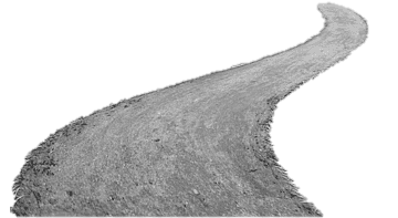
This is a GPX route that I have done. It has about 60-70% gravel roads. It has a few dirt road sections and creek crossings. One of the creek crossings can be slick. A few road closed signs but bikes can get through. The end of the ride after the last gas stop has the most paved roads to get you back to the Dam.
This is a self guided tour at your own risk on your own bike. Please note that road conditions can change, and please be respectful of public roads so other can enjoy this route in the future. Usdualsports is in no way responsible for your riding skills and how you use this GPX file.
GPX
As many of us know creating GPX routes is time consuming and most people won't share their creations. Please consider Thanking the creator of this loop by purchasing the GPX file. No worries if not use Coupon Code FREEGPX at checkout on non premium routes to remove donation.
Free GPX Download using Coupon Code- FREEGPX at checkout.
Premium GPX Routes do not apply.
Disclaimer
Disclaimer & Rider Responsibility
This is a self-guided route intended for experienced riders. By downloading this GPX file, you acknowledge that you are riding at your own risk and are solely responsible for your own safety and navigation. Road conditions can change rapidly due to weather or maintenance; always ride within your skill level and stay alert. Please respect all public and private lands to ensure these routes remain open for the community. USDualSports is not liable for any injuries or damages incurred while using this data.
I did this route a few days ago, and it was a blast. About plenty of gravel and a few dirtish sections. There are a few road closed sections, but they are bridges out for cars, and a bike will fit through the barricades. The last 68 miles has more road but its mainly getting you back to Williams Dam.
Usdualsports
August 11, 2025 at 7:28 amI did this route a few days ago, and it was a blast. About plenty of gravel and a few dirtish sections. There are a few road closed sections, but they are bridges out for cars, and a bike will fit through the barricades. The last 68 miles has more road but its mainly getting you back to Williams Dam.